Where we walk. See our trip reports for more details.
Click to see some pictures:
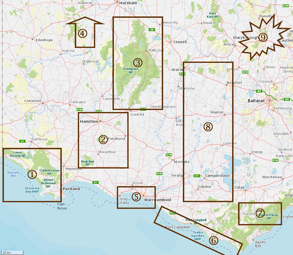
1. The Great South West Walk goes through four national parks and provides us with ample day walks as it winds through forests, follows the Glenelg River, and sticks to beaches and cliff tops.
2. Some short walks often done in pairs. Budj Bim, Byaduk Caves, Mt Napier and Mt Rouse provide obvious reminders of our volcanic past, Wannon and Nigretta Falls less so. There's the Hamilton to Coleraine rail trail and Lake Linthgow provides a pleasant start for a bike ride on quiet back roads.
3. The Grampians provide lots of walks. Mt Abrupt with a full pack is the training walk of choice for those in need, but a pleasant morning walk for the others.
4. Wyperfeld is a couple of hours drive north of the map edge. A two night base camp is a perfect way to celebrate the AFL grand final holiday: flowers, food and fine day walks.
5. Warrnambool is our home turf. A short walk along the promonade on Tuesday and Thurday evenings. Various walks of two to three hours in town or on the coast west to Port Fairy. Plus the once-a-year-at-the-lowest-low-tide beach walk between the two towns. Or the same by bike along the rail trail via Koroit. And not to forgot the jewel: Tower Hill.
6. The coast between Warrnambool and Cape Otway provide lots of day walks as a combination of cliff top, beach, management track, and, of course, the Great Ocean Walk.
7. Driving into the sun there and back is one reason we don't visit the Otways often. Leeches would appear to be another. All the same we go to Lake Elizabeth, The Beechy Rail Trail, and waterfalls around Lorne and Beech Forest.
8. Mounts Noorat, Sugarloaf, Leura and Elephant are done every year, Langi Ghiran and Mt Cole, with its 2-day Beeripmo walk, less often. Some quiet back roads and the Skipton and Timboon rail trails cater for the riders.
9. Every so often we leave our familiar territory.